
Calf Creek Falls is a southern Utah landmark and the major feature of the BLM's Calf Creek Recreation Area. Walking between mineral-streaked cliffs of Navajo Sandstone, hikers pass beaver ponds and pre-historic rock art sites enroute to the 126-foot-high Lower Calf Creek Falls.
Round trip distance to the falls is 5-1/2 miles. While little elevation change is encountered, most of the trail is sandy, and can be very strenuous walking, particularly in warm weather. However, the falls area, once reached, is a delightfully cool, shady haven well worth the effort.
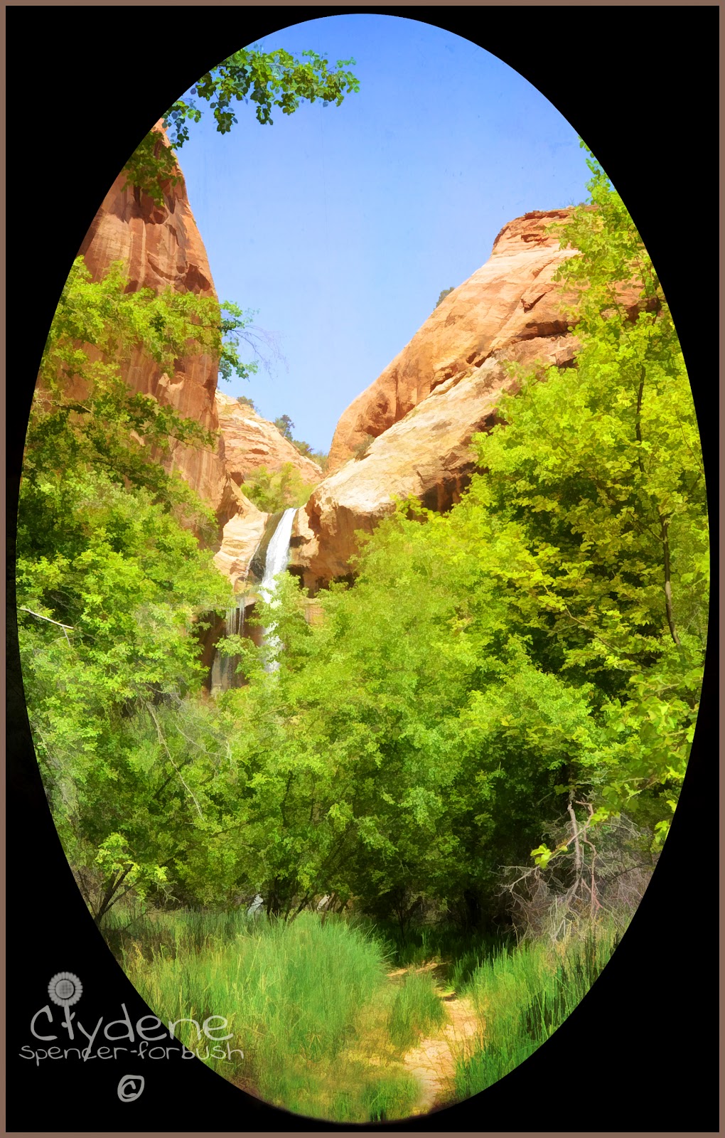
Our journey begins.


The Upper Falls, located farther upstream, can be reached only by a difficult one-mile hike over sandstone slickrock from the Escalante-Boulder highway, 5-1/2 miles north of the campground.
Calf Creek is a clear stream which runs yearlong from its headwaters some 7 miles north. The road across the canyon to the east, State Highway 12, was built by the Civilian Conservation Corps (CCC's) in 1938. Until then, mail and supplies were carried to Boulder by mules and pack horses over Hell's Backbone Road or the Boulder Mail Trail, both hazardous routes. Boulder is said to be the last town in the United States to have mule train mail delivery.
Early on the trail, you will encounter Utah juniper trees (Juniperus osteosperma). Commonly called "cedars", these junipers are used locally for fence posts. The seeds ("berries") are eaten by wildlife. Dried seeds are used by Native Americans for making jewelry.
You will also see pinyon pine trees (Pinus edulis). Pinyon is popular for Christmas trees and produces an edible nut, long used as a staple food by Indian people. The nuts are an important food source for rodents and birds. Resin from these trees was also used by Indians to waterproof baskets and to cement turquoise stones to jewelry.


Further up the canyon, just below the rim, high on the cliffs east of the creek, you can see an ancient storage structure (granary) built some 800 to 1,000 years ago by Indians who farmed the canyon bottoms and stored their produce in these high, dry, probably rodent-proof structures. Peoples of both the Anasazi and Fremont cultures were residents in the area at the time these structures were built. Further archaeological work is needed to determine which group built these structures. You may also see four large figures painted in red on the cliff wall. Typically Fremont in style and form, these thousand or so year-old pictographs could represent deities or culture heroes, or a ceremony or event may be depicted.
The predominant geologic formation in this area is the cliff-forming Navajo sandstone. As you look at the canyon walls you can see the typical cream to red-colored sandstone layers formed millions of years ago by ancient sand dunes. Vertical discoloration is created by rain water running down the cliffs.


In the early 1900's a local farmer grew watermelons along the bank of the creek. They were said to be, "the best melons in Boulder"


My first glimpse of the falls!


Calf Creek Recreation Site and Campground (elev. 5,346) is located along Utah Highway 12, 15 miles east of the Town of Escalante. Facilities at this site include individual camping units, five individual picnic units, a group picnic area, and a 2-3/4 mile (one-way) interpretive trail to the 126-foot Lower Calf Creek Falls. Other developments at this site consist of a culinary water system, playground equipment, 2 volleyball courts, a paved road, paved parking area, vault toilets, and a foot-bridge across Calf Creek. Camping fees are $5.00 per night on a first-come basis.
For additional specific information about the two waterfalls and associated campground, call the Interagency Visitor Center in Escalante: 435-826-5499.


7 comments:
what a great weekend :)
GORGEOUS!!! We'll have to check that place out for sure!!!
What a beautiful hike you made! Now I am sure I want to return some day!
What a grand hike! Such beauty and lots of things to explore! Adore the petroglyphs!
Hopeyou don't minde that your cousin, the theif, has been pilfering your blog again. Can't help it. your photos are gorgeous. You all live in God's Country.
Sounds like an awesome hike! Love the pics as always, Whitey. BEAUTIFUL!!
Happy Weekending!
I may have to steal one of these gorgeous photos for my Facebook Cover Pix!
Post a Comment